Maps Are The Coolest
January 2026 Imperfect Union
Today, I wanted to share a sneak peek into a fun research rabbit hole. But, in case you missed it, I wrote a longer piece last week for the 250th anniversary of Common Sense and why it still matters today.
As I’m writing and sharing more often, I am trying to balance a more serious people with the research joy. This process is an experiment, so please feel free to let me know what works and doesn’t work for you, what you want to see more of, etc.
For today, however, we are going to have a little fun with maps. People often ask, if I could go back in time and listen to one conversation or witness one event, what would it be? I have trouble selecting just one because the truth is, I’d love to just wander. I want to walk on the cobblestones, stare into the houses looming over the shaded alleys, smell the unique mix of cow manure, pigs, and city life, and listen to the merchants peddling their wares. Daily life—the small details that made up a city—are what interest me most.
Don’t get me wrong, I don’t want to live in the past. I like vaccines, antibiotics, and running water, thank you very much. I also enjoy wearing pants. I’d just like to experience it for one day.
Since that is not possible, one of my favorite parts of research is recreating what a community looked like on a really neat old map. Maps are the coolest.
This map shows Boston in 1806 and is from the Leventhal Center at the Boston Public Library. I’ve marked it up to show a couple of locations relevant to John Quincy Adams’s life in the first decade of the nineteenth century. You can find the full map HERE if you want to really zoom in and explore all the streets. The high resolution is amazing.
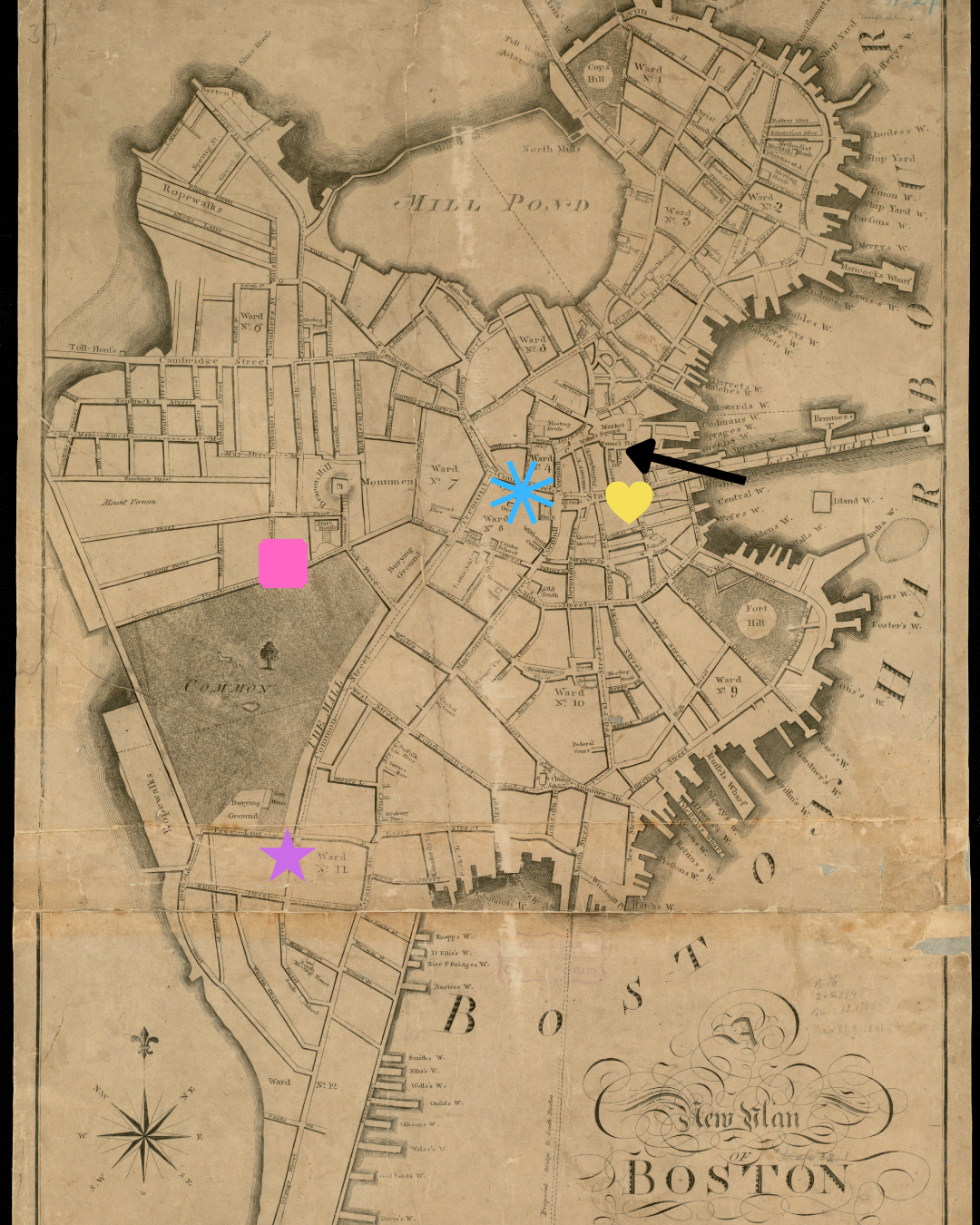
Purple star: John Quincy and Louisa Catherine Adams’s house on Nassau Street
Blue star: JQA’s law offices (and where most of the legal offices were located). I think it’s fascinating that lawyers tended to have their offices together, as did the insurance and banking offices. This practice is probably borrowed from the British, as many barristers held their offices at Inns of Court in London.
Yellow Heart: Insurance and banking offices
Black Arrow: Faneuil Hall
Pink Square: Home of Harrison Gray Otis, state senator and president of the state senate. Frenemy of both JQA and John Adams.
Mill Pond: Popular spot for bathing during the summer
Common: Also known as the Mall, JQA’s favorite walking spot
He would have traveled pretty much everywhere in the city on foot. It is not hard to imagine him walking up Common Street to his offices or maybe Marlborough Street to attend a town meeting at Faneuil Hall.
Below is an engraving of Faneuil Hall in 1775. By 1800, Boston would have been built up a bit.
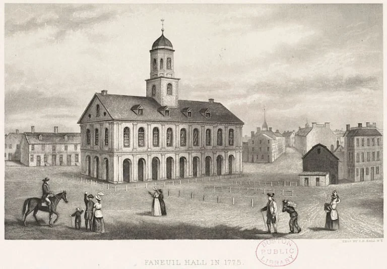
The engraver of the photo below lived from 1805-1855, so that gives us a range of probably about 1830-1855 for the photo. I like the two together because they show the development of the city, but still retains its provincial feel.

Thanks for joining me on this little adventure! Where would you go first if time travel was possible? Where city would you wander?
Map Credit: Norman, William. "A new plan of Boston : drawn from the best authorities with the latest improvements, additionas and corrections." Map. Boston: Sold by W. Norman ; sold also by Wm. Pelham, 1806. Norman B. Leventhal Map & Education Center, Boston Public Library, https://collections.leventhalmap.org/search/commonwealth:x633fb64x (accessed January 15, 2026).